
The Van Buren County Digital Information Department (DID) is excited to introduce a growing suite of interactive maps designed to help you easily explore and navigate Van Buren County’s rich spatial information. These FREE tools provide easy access to a wealth of geographic data, all through a user-friendly platform. Each interactive viewer is focused on a specific topic or area of interest—whether you’re researching property details, interested in land patents, or exploring hydric areas for land use planning.
To access all available interactive maps, check out the Van Buren County Interactive Map Portal. Below, you’ll find more details about each map:
Parcel Viewer
The Parcel Viewer is your gateway to all county parcel data. Here, you can search for the most current tax, valuation, and ownership information. You can view parcel dimensions, owner names, and create custom maps that can be printed or downloaded as PDFs. Plus, we’ve introduced an interactive AI helper called MapBuddy to answer your questions and guide you through your searches.

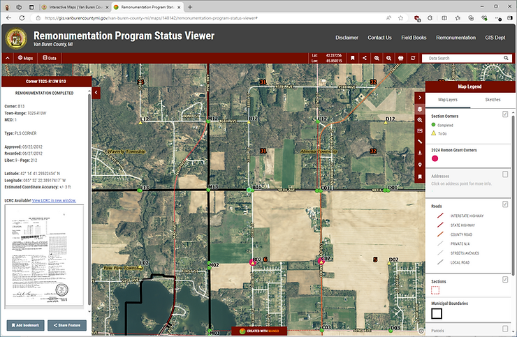
Remonumentation Program Status Viewer
Curious about the status of the Remonumentation Program? This viewer shows which section corners have been remonumented as part of the statewide effort to restore Public Land Survey System section corners. You’ll be able to see detailed updates about the program, including Land Corner Recordation Certificates, helping you stay informed on this ongoing initiative.
Land Patent & Public Land Survey System Viewer
Step back into history with our Land Patent & Public Land Survey System Viewer. You can explore original Land Patents issued in the 1830s—just click on an area of interest to see what land patents are available. Additionally, you can delve into the Public Land Survey System to better visualize sections, quarter sections, and other divisions throughout the county. This map also includes links to the original General Land Office Survey Maps from the 1820s-1830s, perfect for those looking to understand historical land descriptions.

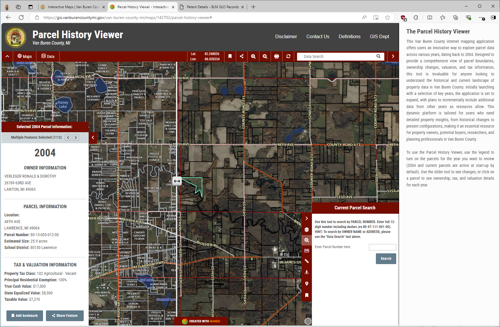
Parcel History Portal
Our Parcel History Portal allows you to track parcel changes across Van Buren County from 2004 onwards. Whether you’re looking to investigate historical boundaries, ownership changes, or property valuations, this tool provides a detailed view of the county’s property evolution. We’re starting with key years and plan to expand as more data becomes available—ideal for property owners, potential buyers, and researchers interested in historical property data.

Hydric Areas Viewer
The Hydric Areas Viewer provides an in-depth look at Van Buren County’s natural water resources. This interactive map incorporates data such as the National Wetlands Inventory (NWI), hydric soils, FEMA flood plains, and watershed boundaries. Whether you’re a land-use planner, conservationist, educator, or simply curious about the county’s natural environment, this tool is designed to support informed decision-making for sustainable community planning and environmental resilience.

Explore all these tools today and discover what Van Buren County has to offer. Whether you’re a property owner, a researcher, or just curious about local history, there’s something for everyone.